TRAINING WORKSHOP ON GEOSPATIAL INFORMATION AND AGRICULTURAL STATISTICS
Methodology and Applications on the Integral use of Geospatial Data to support Improved Agricultural Monitoring through Area Frame development and Multiphase sampling for the Sustainable Monitoring of Agricultural Land in Afghanistan.
Dubai, United Arab Emirates
[huge_it_slider id=”1″]Course Goals:
To train resources 6 persons of MAIL in approaches for the operational integration of Geospatial data for crop area estimation for Rice and Cotton.
Objectives of Training:
The Food and Agriculture Organization of the United Nations (FAO) is collaborating with the RASIL under the project “Strengthening Afghanistan Institutions’ capacity for the Assessment of Agriculture Production and Scenario Development” to support the implementation of an Operational Agricultural Monitoring System for Rice and Cotton for Afghanistan. The main objective of the proposed workshop is to provide a hands-on capacity building program for national experts on Agricultural Monitoring based on the integral use of Geospatial data and applications for crop area estimation.
Training team
- John S. Latham (Lead- RASIL) (Former Head of Environmental Monitoring Unit UNFAO)
- William Wigton (International Expert on Agricultural Statistics)
- Hatim Nuh (GIS and Remote Sensing Expert)
- Christopher Auricht (Big Data and Information Systems Expert)
- Sadig Elamin (Facilitator – RASIL)
Agenda
Day 1: Geospatial Information for Agricultural Statistics: A Foundation for Operationalizing Regular Crop Monitoring in Afghanistan
- Introduction: Earth Observation data for Improved Agricultural Statistics Estimation: A Foundation for Operationalizing Regular Crop Monitoring in Afghanistan: John Latham
- Agricultural Data requirements including the Sustainable Development Goals.: William Wigton
- Introduction of Methods and Statistical Terms: William Wigton
- Earth Observation data for Improved Agricultural Statistics Estimation: John Latham
Day 2: Area Frame Development
- Area Frame Development: William Wigton
- Big Data – challenges and opportunities: Christopher Auricht
- Satellite Remote Sensing: William Wigton
- Tips for using current S/W for R.S Big Data Processing: Hatim Nuh
Day 3: Area Frame Development
- Area Frame Development
- Construction of an Area Frame for Agricultural Statistics: William Wigton
- Integration of socio-economic and biophysical data for multi-criteria analysis: Christopher Auricht
- Satellite Remote Sensing: John Latham
- Area Frame Development and the Importance of a Harmonized Land Cover
- Development of Area Frame: Hybrid Estimator
Day 4: Digital Processing of Satellite data
- Digital Processing of Satellite data: William Wigton
- Preparation of the TSU, Interpretation of the Segments and field data collection: John Latham
- Implementation steps : William Wigton
- Resource requirements for setup and frame construction
- Resource requirements for recurrent charges and operational costs: William Wigton
- Crop Estimates: John Latham
Day 5:
- Recommendations and way forward –: ALL
- Developing the next steps
- Workshop evaluation and feedback
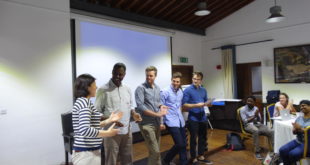
Participants
The training workshop was attended by participants from MAIL, Statistics Division and FAO project manager, who need to know how satellite technology can be a tool for them to improve the timeliness and efficacy of crop area estimates. The course covered both the theoretical as well as practical basis of crop area estimation using Geospatial information as well as a variety of estimators and improved hybrid methods for the precise estimation of critical crops.
Workshop resources:
- Training workshop report
- Presentations:
- Introduction
- Earth Observation data for Improved Agricultural Statistics Estimation: A Foundation for Operationalizing Regular Crop Monitoring in Afghanistan:
- Afghanistan: Monitoring of Cotton Crop Using Satellite Remote Sensing and GIS Technology (SUPARCO):
- Cotton Crop (Status of Acquisition)
- Rice Crop (Status of Acquisition)
- Rice Crop Estimation
- Area Frame Development
- Area Frame and Importance of a harmonized Land Cover
- Image classification
- Agricultural Survey Design Multiple Frame
- Big Data – challenges and opportunities
- Cadaster and resource information systems
- Integration of socio-economic and biophysical data for multi-criteria analysis
- FAO and the Agenda for Sustainable Development Goals (SDGs)
- Photos
- Contacts: Participants and resource persons