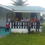
RASIL’s lead consultant reviewed the utilization of Geographic Information Systems (GIS) within Guyana’s Ministry of Indigenous Peoples’ Affairs (MoIPA) and provided short training to 10 MoIPA staff in the use of GIS; map reading and interpretation of GIS data; and application of GIS tools to delineation and demarcation of boundaries.
Tags slider
Check Also
Agri-Monitoring
TRAINING WORKSHOP ON GEOSPATIAL INFORMATION AND AGRICULTURAL STATISTICS Methodology and Applications on the Integral use of …
 Welcome to Rasil We strive for excellence


